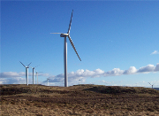
 Atmos Consulting is developing a computer model which attempts to make sense of the complexity of understanding and predicting the cumulative visual impact of wind turbines.
The aim is to attempt to model and display the intensity of visual impact arising from wind turbines in a format which can be more readily understood by planning authorities, statutory consultees and the general public.
The recent SNH guidance on ‘Assessing the Cumulative Impacts of Onshore Wind Energy Development’ recognises the expensive, time consuming nature of assessing cumulative visual impact and advises that the assessment should ‘focus on the likely significant effects and, in particular, those which are likely to influence the outcome of the consenting process’.
However, identifying when a project is actually likely to have a significant cumulative impact is not straightforward. Atmos uses GIS (geographical information system) modelling techniques to map the intensity of cumulative wind farm visibility against built, consented or proposed turbines. The Atmos mapping methodology takes relative distance, size and perspective into account. The model produces colour coded illustrations quickly and inexpensively, highlighting the additional impact of a proposed new development.
It is an alternative to the present method of representing cumulative impact by a laborious series of illustrations of overlapping Zones of Theoretical Impact (ZTV) for each existing or proposed development. The result of the current process is often a mass of data and a considerable number of figures which can be very difficult to interpret.
The Atmos model attempts to replace the simplistic approach of showing the number of wind farms visible, with an analysis of the number of turbines, as clearly it makes little sense to treat a single turbine as having the same visual impact as a large wind farm. The GIS programmers have also allowed for distance decay effects, relating visual intensity to distance using latest thinking on fuzzy viewsheds.
Encouraged by positive feedback from developers and planners alike, Atmos continues to invest in improving the model and is currently working with a number of landscape architects to build in assessments of horizontal angle of view, rather than number of turbines visible, the screening effects of forestry and buildings and the influence of the vertical range of the topography (e.g. agricultural plain or upland plateau vs. rolling hills).
“This is an exciting project that attempts to address a problem that developers, their advisors, planning authorities and statutory agencies have been grappling with for years,” said Atmos Consulting director Fraser Mackenzie.
“Our award winning GIS team is continually at the forefront in developing new, innovative models that create cost and time efficiencies for our clients. We are confident that the new cumulative visual impact tool will be of use to those planning and assessing wind farm projects.”


